
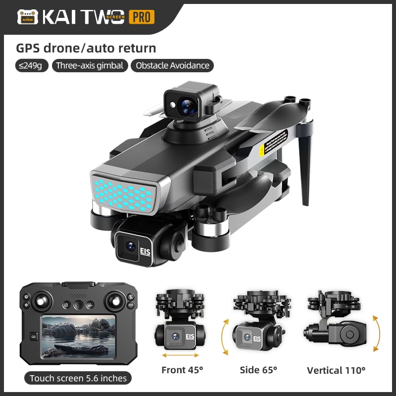
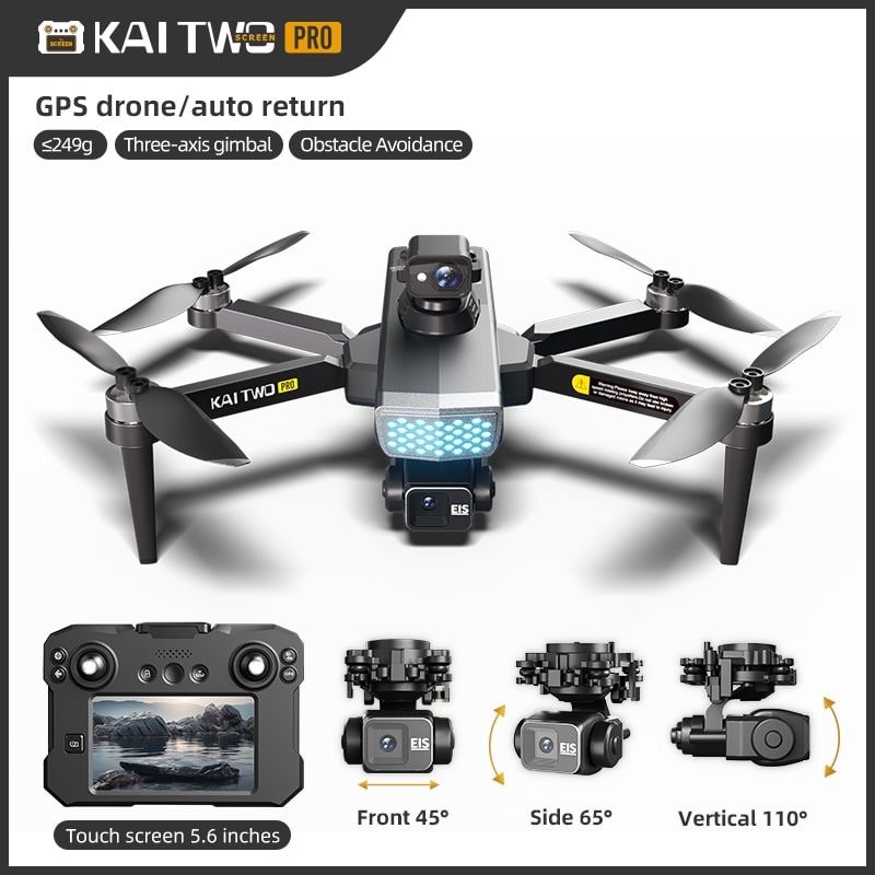
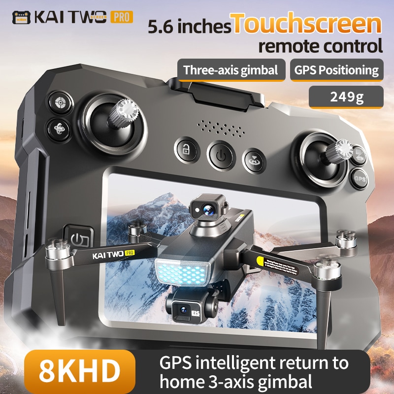
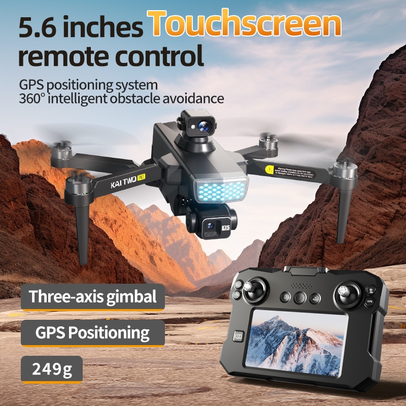
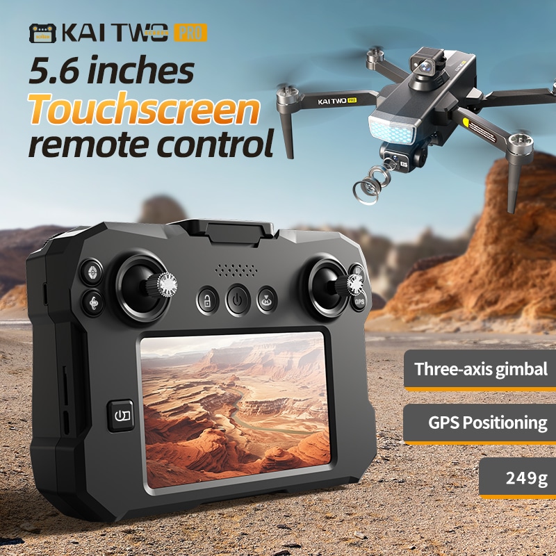


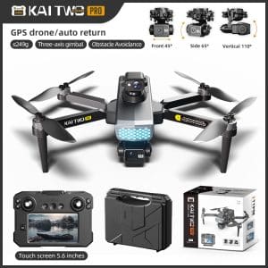
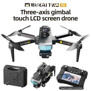
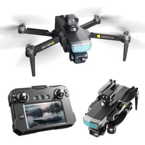
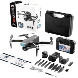
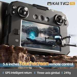
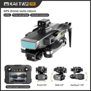


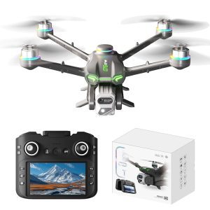
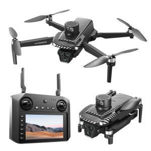
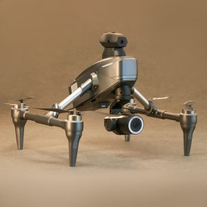
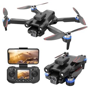
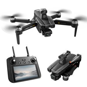
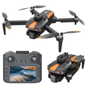
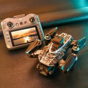
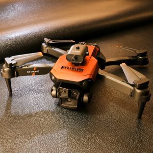
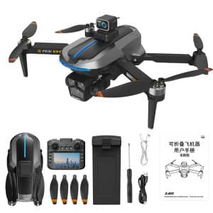
KAI2MAXプロフェッショナルGPSドローンは、卓越した空中撮影を実現するために設計されており、3軸メカニカルジンバルとEIS手ぶれ補正を搭載し、極めて滑らかな4K映像を提供します。 デュアルGPSと光学フロー測位システムによる安定したホバリング性能を備え、最大2000メートルの高度まで確実な飛行を実現。360°レーザー障害物回避機能とインテリジェントワンキー帰還機能により、信号喪失時やバッテリー残量低下時に自動作動する包括的な安全性を確保。堅牢な構造と高度な自律飛行技術を融合し、プロフェッショナル品質の映像・写真撮影を可能にする信頼性の高いツールです。.
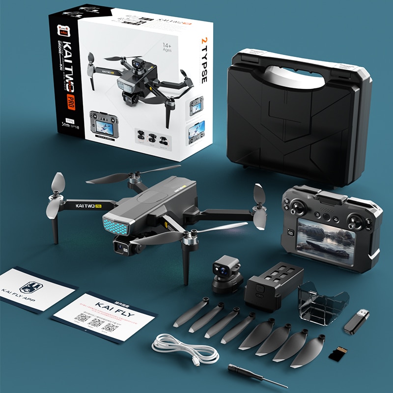
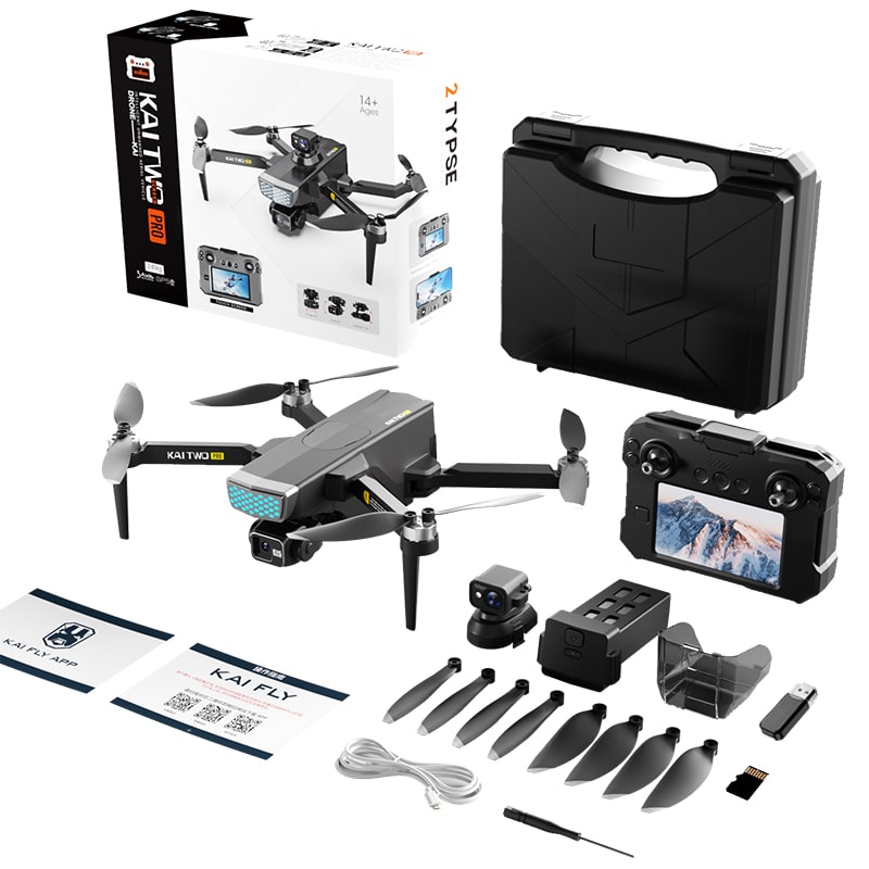
製品の特徴:
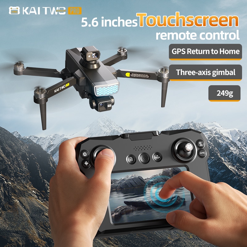
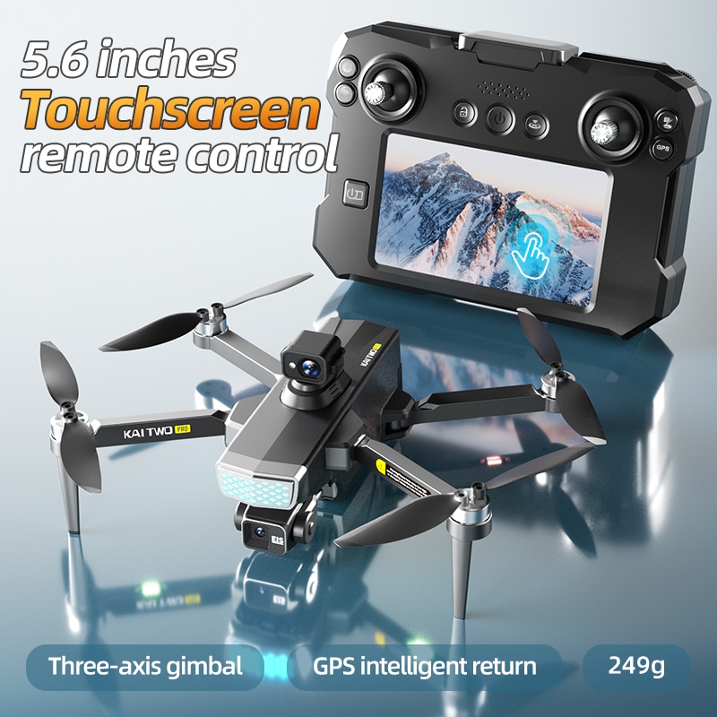
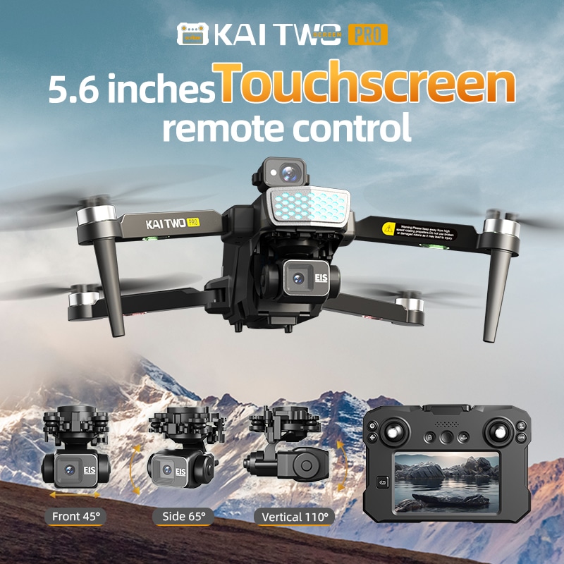
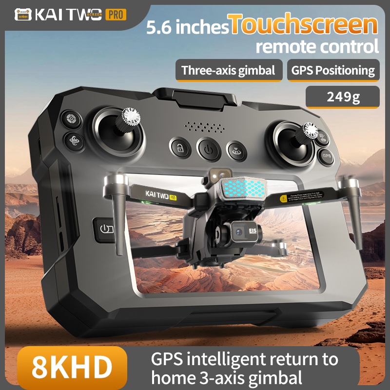
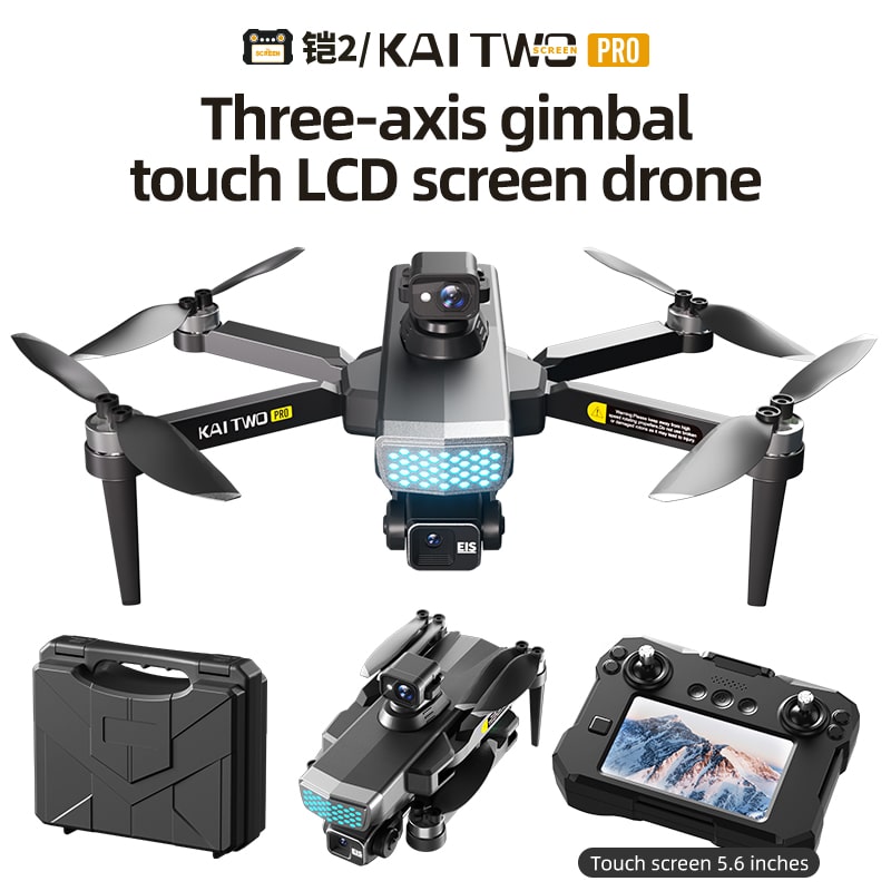
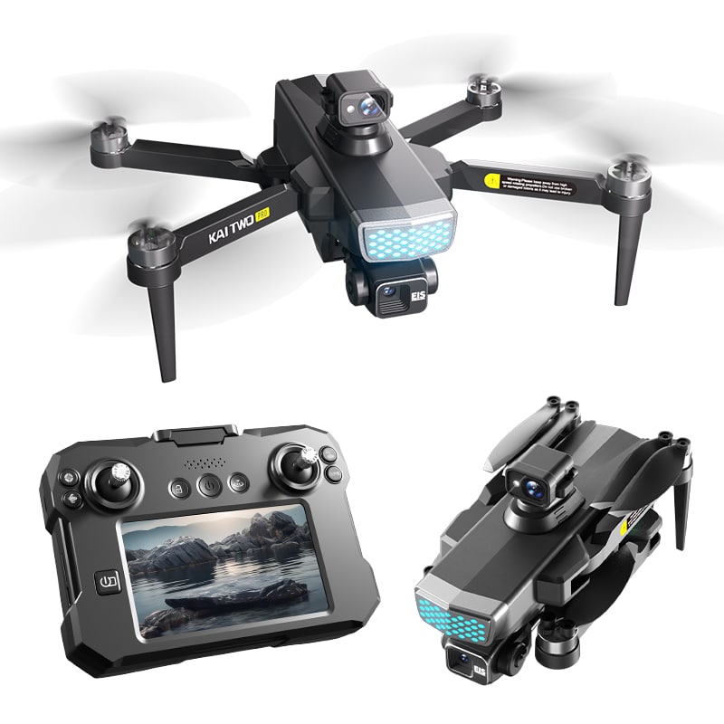
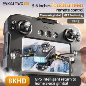
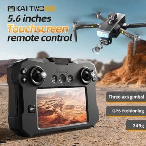
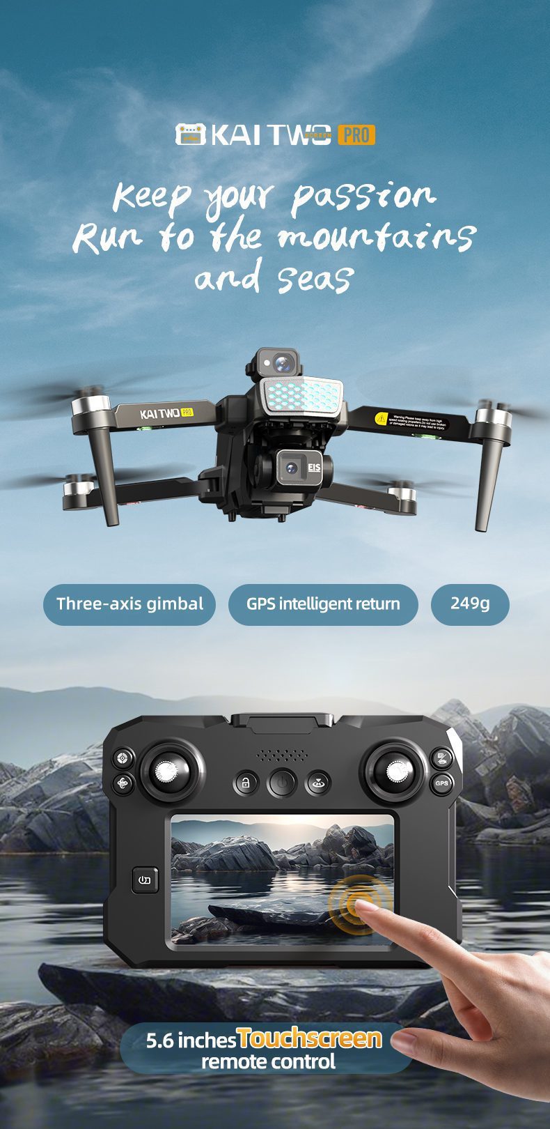
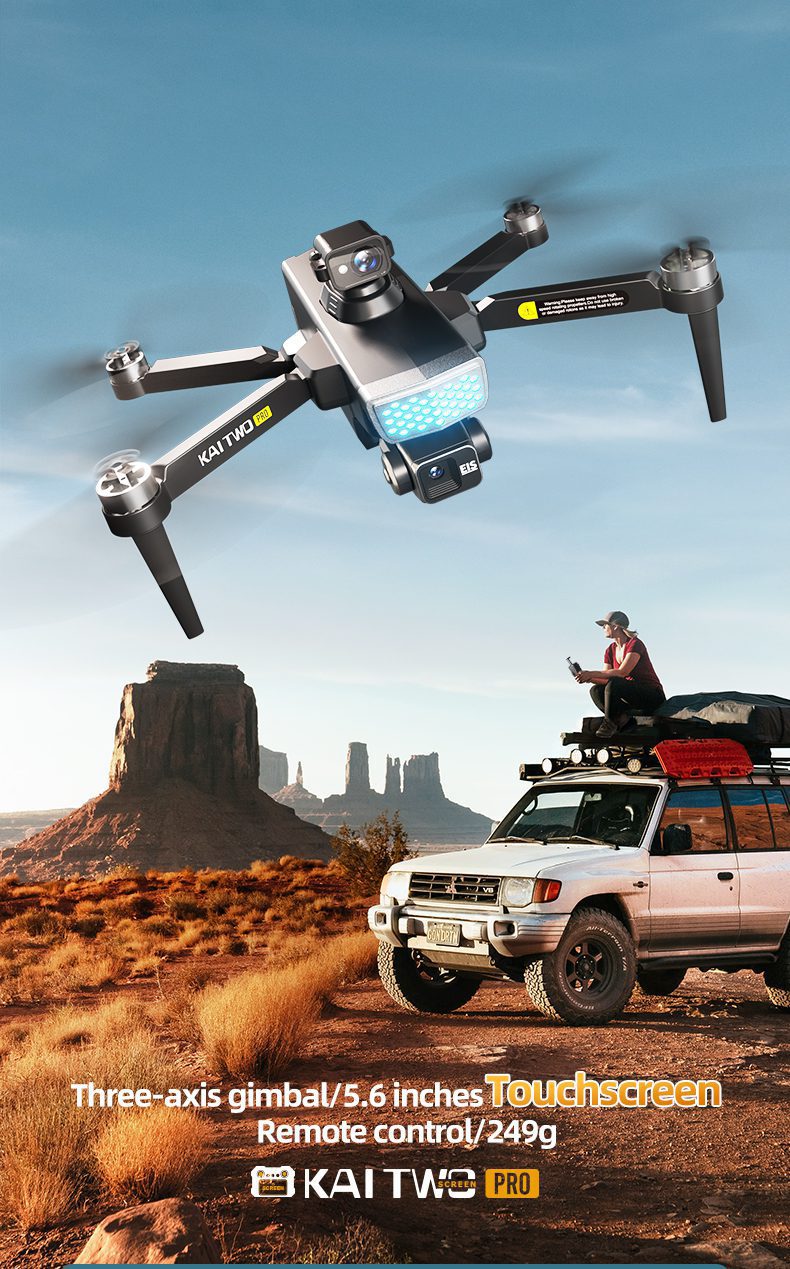
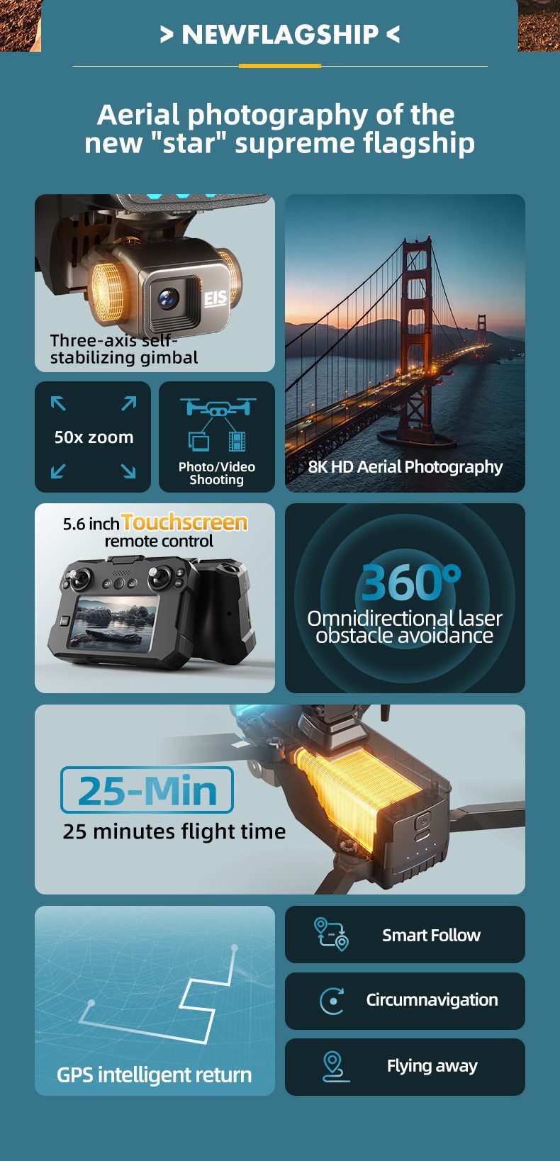
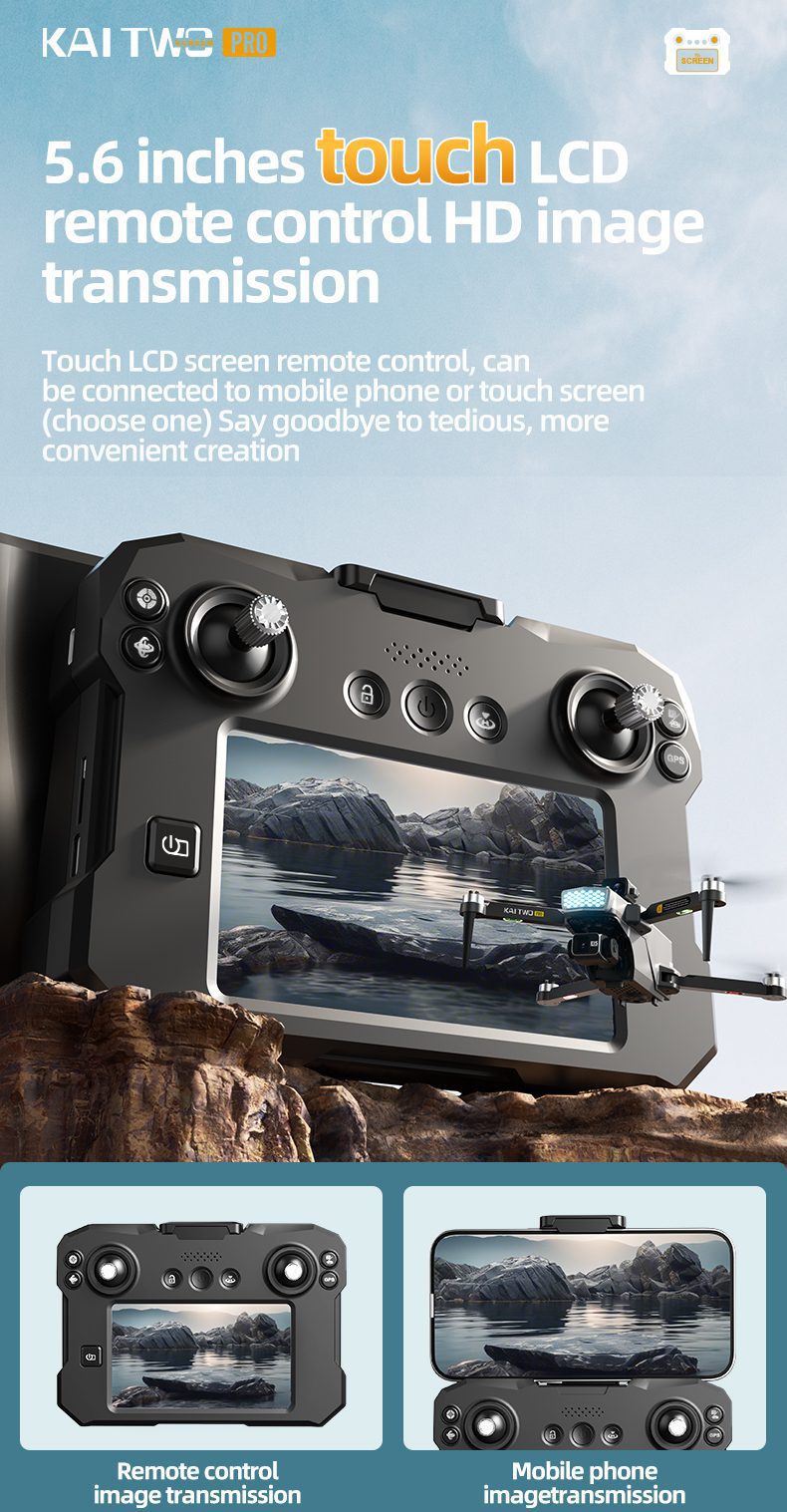
- 5.6インチタッチスクリーンによるリアルタイム画像伝送
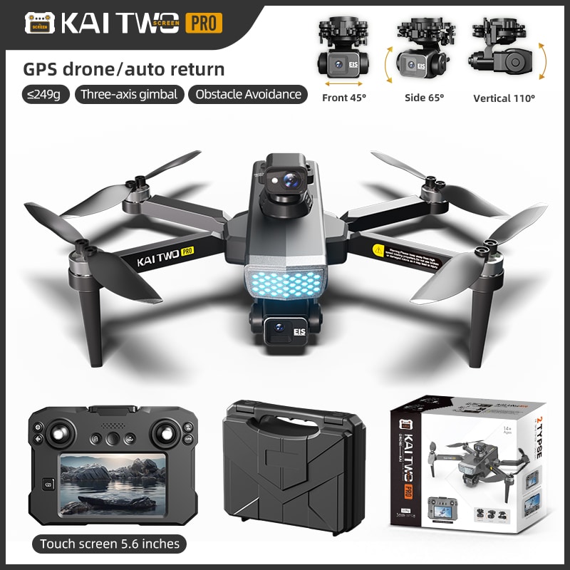
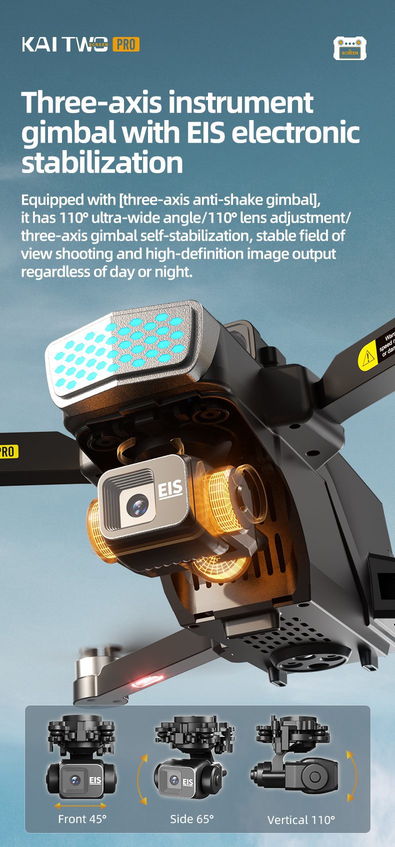
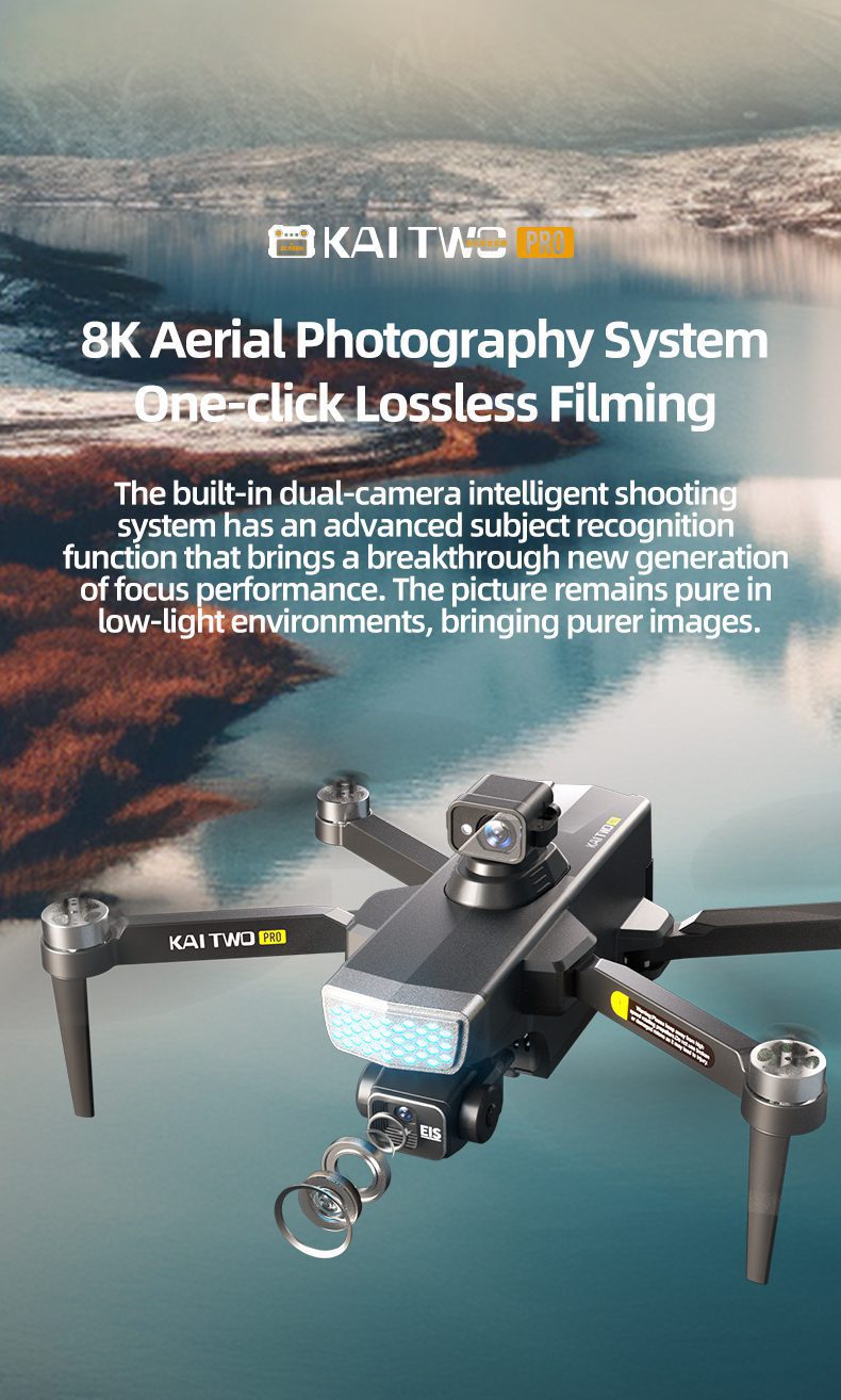
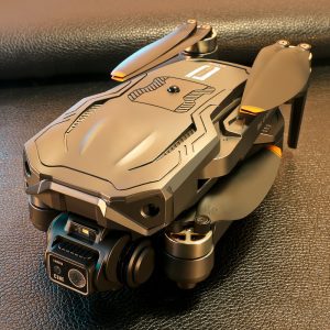
- 三軸機械式ジンバル、4K画素
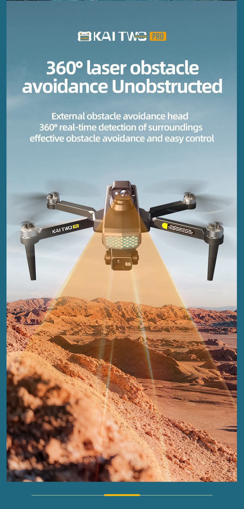
- 360°全方位レーザー障害物回避
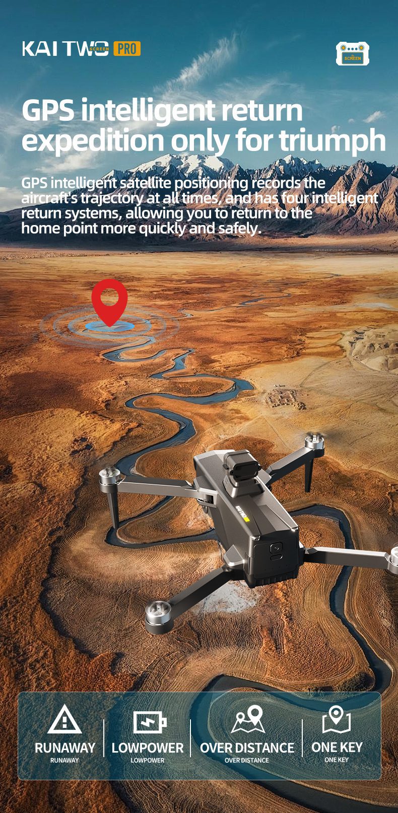
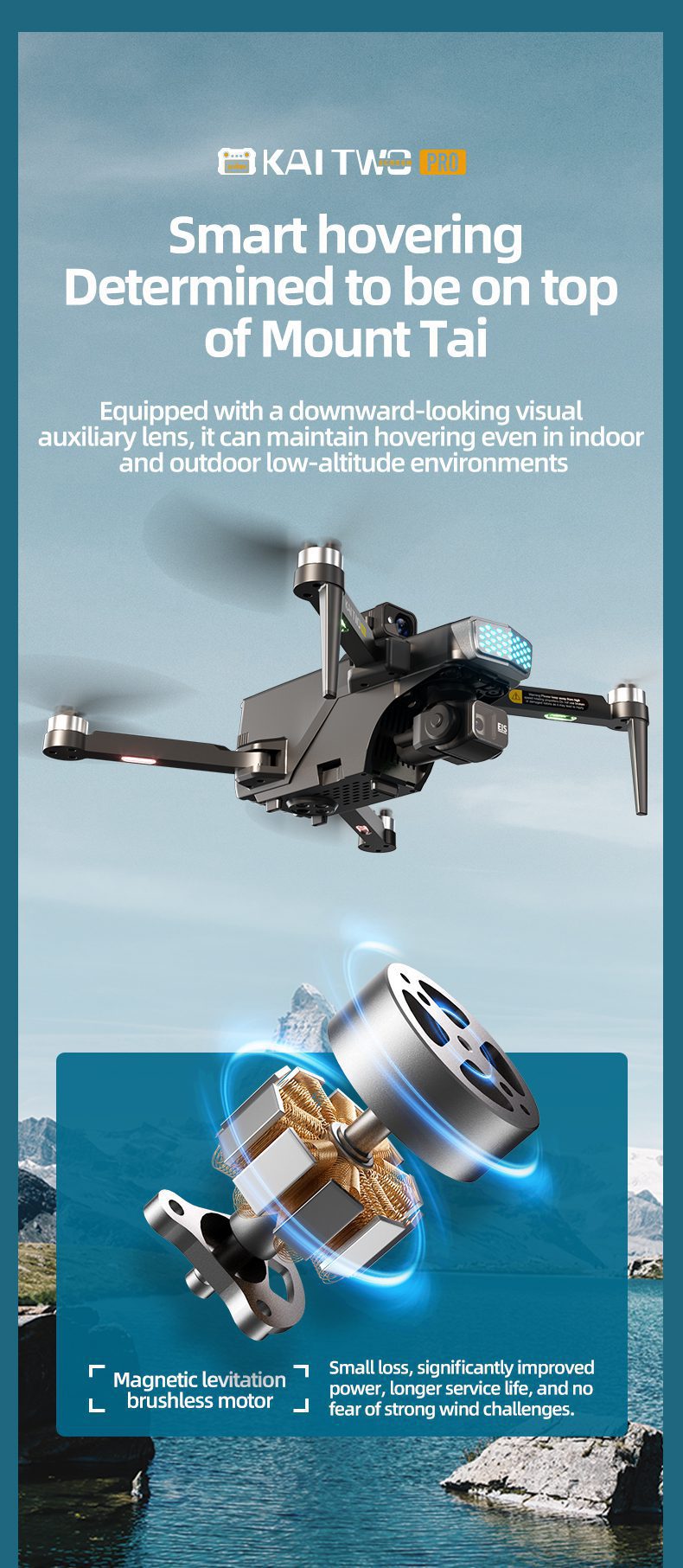
- GPS測位+オプティカルフロー測位 デュアルモード
- ブラシレスモーター、7段階風量調節
- 逃亡リターン、低電力リターン、ワンクリックリターン
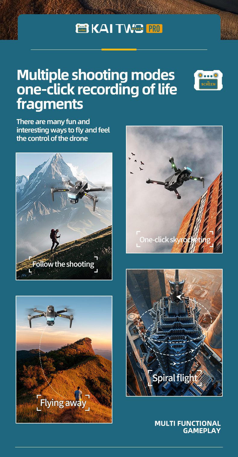
- スカイモード、グラデーション距離モード、パノラマ撮影
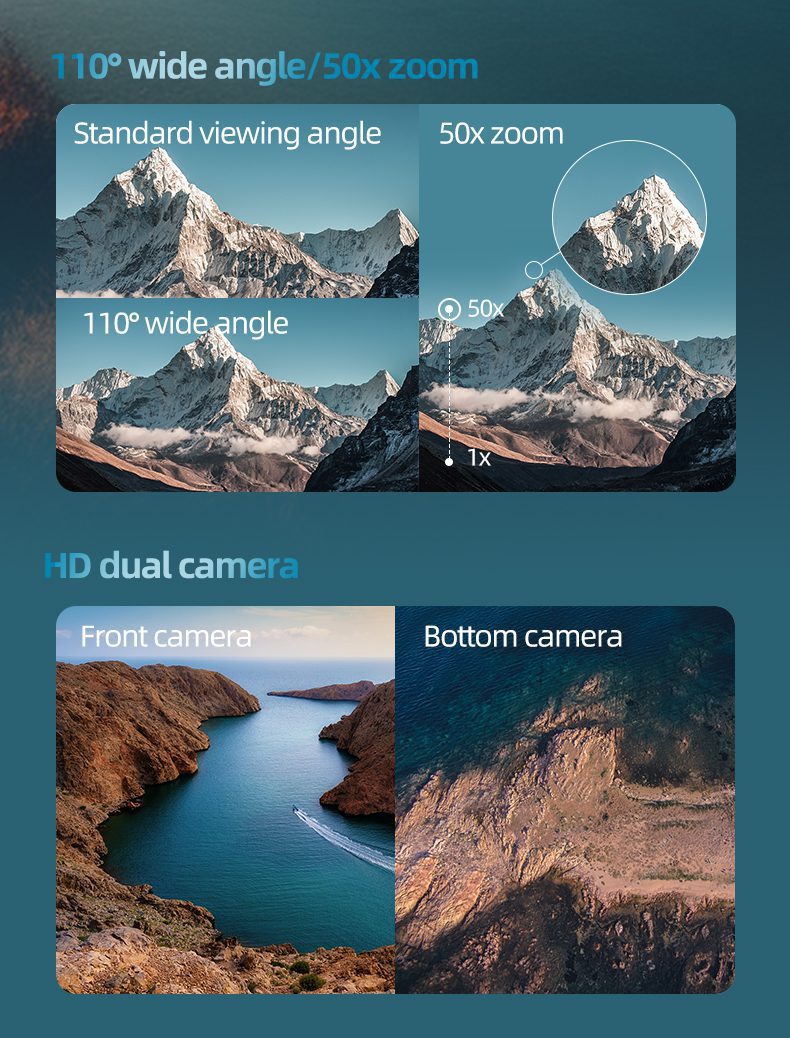
- インテリジェントフォローアップ、画面50倍ズーム、ポイントオブインタレストで囲む
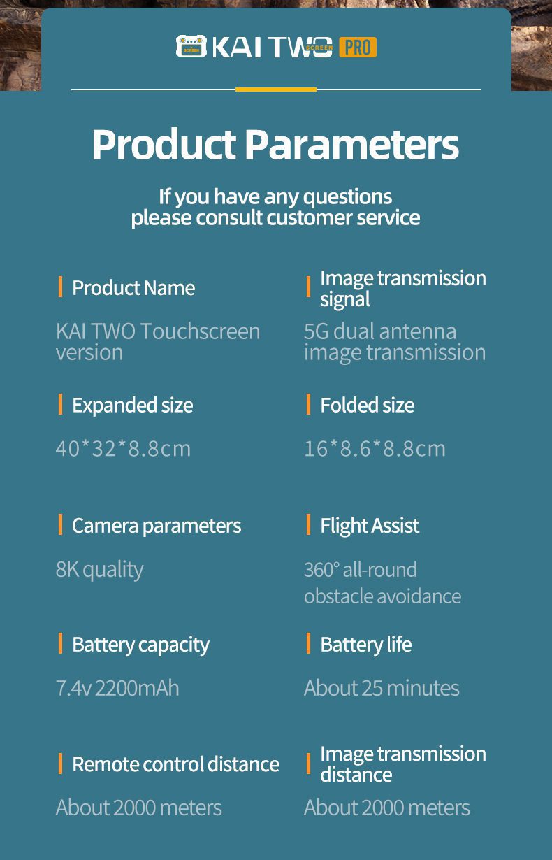
製品パラメーター
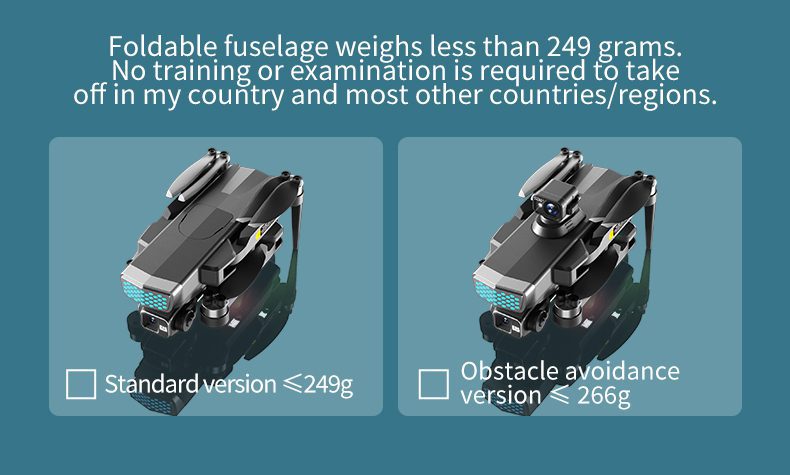
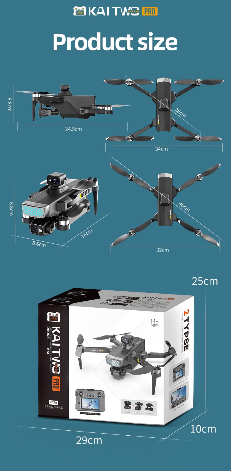
- 本体重量:249g(標準版)、266g(障害物回避版)
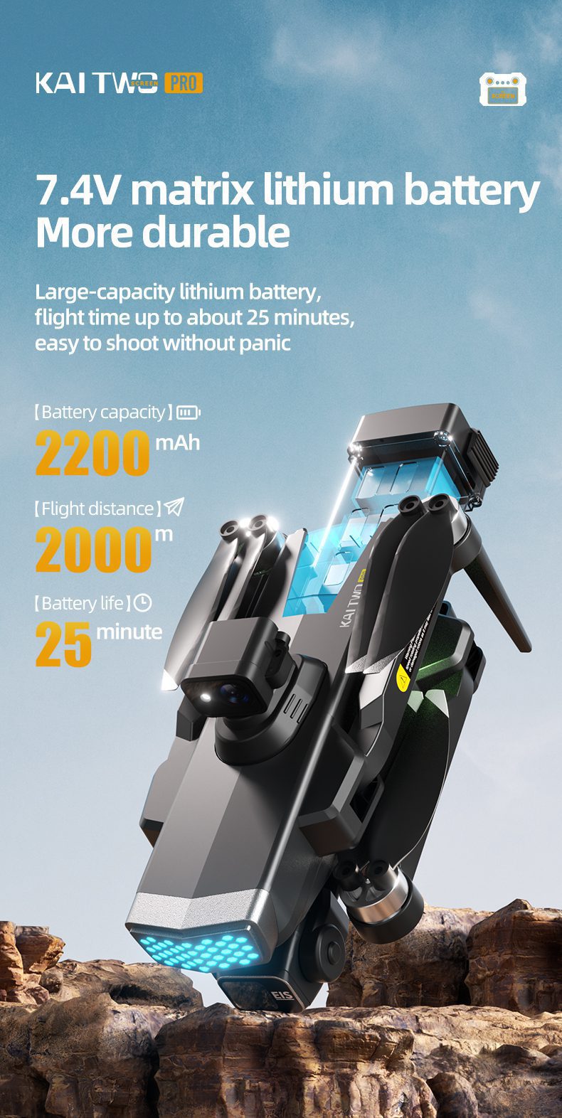
- バッテリー容量:7.4V 2200mAh
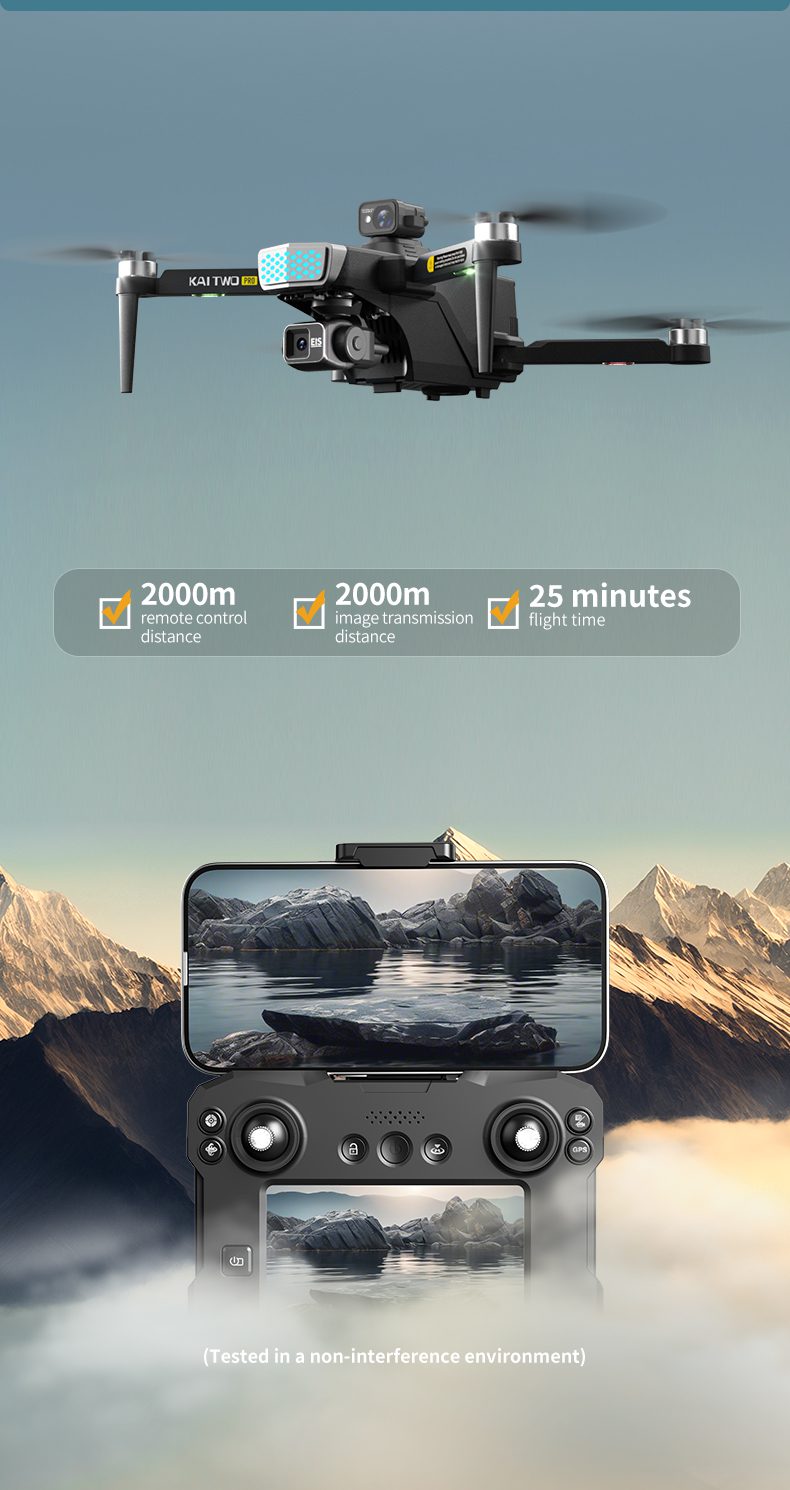
- バッテリー寿命:25分
- リモコン操作距離:約2000メートル
- 画像伝送信号:5Gデュアルアンテナ画像伝送
- ビデオ画素数:1920ピクセル×1280ピクセル(前面カメラ)、1280ピクセル×720ピクセル(下部カメラ)
- 画像画素数:3840×2160ピクセル(前面カメラ)、1280×720ピクセル(底面カメラ)
- カメラパラメータ:4K画質
- フライトアシスト:360°全方位障害物回避


レビュー
まだレビューはありません